Archaeology is a field that still evokes romantic notions of hat-wearing brave explorers discovering lost cities and treasures. While uncovering the past and placing it in the context of the present is still what it is about, thanks to intensive interdisciplinary cooperation, the results of contemporary research can also be used to tell us something about the future. Research often focuses on the relationship between people and their landscape, which also has important environmental implications.
In this article, four research team leaders from the Faculty of Arts of Masaryk University present their work on remarkable archaeological sites abroad. Inna Mateiciucová works in the mountains of northern Oman, Peter Milo leads a geophysical survey of an early medieval town in Bulgaria, Petra Goláňová regularly visits a Gallic oppidum in France, and Věra Klontza studies water management issues on the island of Crete.
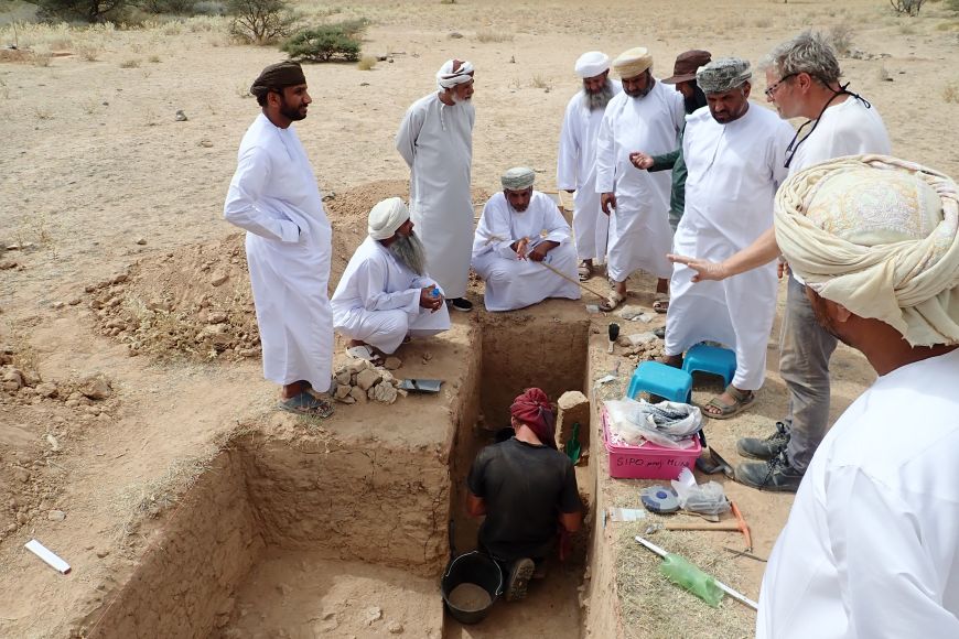
The karst depression Hayl Ajah
The unique site – the extensive karst depression called Hayl Ajah is located in northern Oman in the Al-Hajar mountains, approximately two hours northwest of the city of Nizwa. "Our archaeological work is closely related to the research of climatic and environmental changes during the Late Pleistocene and Holocene. The site Hayl Ajah offers something that is very difficult to find in the Arabian Peninsula and generally in areas with an arid climate – thick layers of sediment. It represents an important climatic archive with significance far beyond the region,” explains Inna Mateiciucová from the centre of Prehistoric Archaeology of the Near East at the Department of Classical Studies. On the rock terraces, archaeologists have uncovered evidence of prehistoric occupation in the form of stone artefacts, pottery and remains of stone structures dating from the Middle Palaeolithic to the Iron Age. “Preliminary analyses suggest that this mountain site was occupied during times when the climate of the southern Arabian Peninsula was gradually drying out and deserts began to spread across the lowlands. Research at Hayl Ajah therefore provides a unique opportunity to simultaneously study climatic changes and the adaptive strategies with which people responded to them,” adds Mateiciucová.

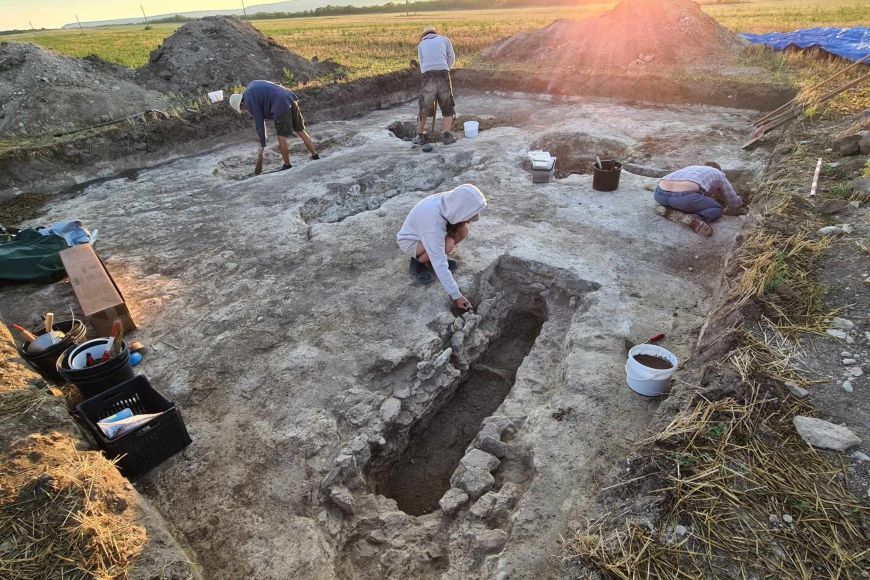
The early medieval town of Pliska
The Pliska site is located in eastern Bulgaria and covers an area of 22 square kilometres. It served as the capital of the First Bulgarian Empire and became the largest European city in the Early Middle Ages. “The geophysical survey has changed our view of what Pliska looked like at that time. It was long thought to be a palace complex with agricultural settlements around it, all surrounded by a rampart. However, our team was able to determine that it was not a concentration of simple settlements, but was originally a planned urban centre with a network of streets lining courtyards surrounded by wooden palisades, residential and agricultural buildings and, in some cases, churches. Using large-scale geophysical (magnetic) surveys, we have explored more than 18 square kilometres in five years,” says Peter Milo from the Department of Archaeology and Museology. Such a large area would take decades to explore using standard archaeological methods, at a huge financial cost. Geophysics allows archaeologists to prioritise interesting sites for excavation. “To give an example, we focused on the ditches because they are the key to understanding the urban development of Pliska. We don’t need to excavate large areas. Based on the geophysical survey of the designated archaeological trenches, we are also sampling the local burial ground and water supply system,” explains Milo.

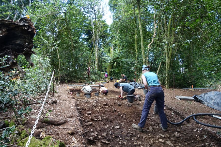
Bibracte – a Gallic oppidum
The site of Bibracte is located in eastern France. It was originally a Gallic fortified town built on Mont Beuvray at the end of the Late Iron Age. “Years ago we explored the settlement here along the main road, which from the beginning included blacksmithing workshops. We have found the remains of production equipment, small metal objects and, exceptionally, jewellery and coins. Throughout the oppidum there is a large quantity of ceramics, especially amphorae, used as containers for wine imported from what is now Italy. More than eight hundred thousand sherds were found at Bibracte,” says Petra Goláňová from the Department of Archaeology and Museology. The results of human activity can be seen not only in the study of buildings and artefacts. “More recently, we have been using scientific analysis to look for traces of human activity in the soil. This allows us to track changes in the landscape over time and see that it looked different in the past than it does today. We found that human pressure on the environment, including deforestation, has been going on since the Neolithic period. At the end of the Iron Age, there were grasslands, scattered trees, including walnut trees, and even grain fields in some places within the walls of Bibracte,” adds Goláňová.

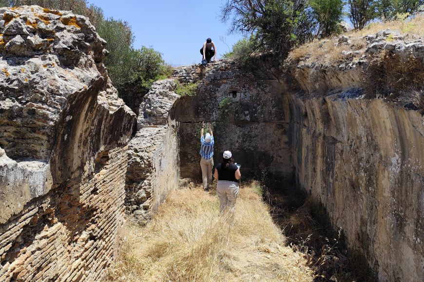
People and water around Ierapetra
The town Ierapetra (historical Ierapytna) is located in the south of Crete at the narrowest point of the island. “Crete is quite unique in that it is geologically very dry. For thousands of years, people here have been collecting and storing water during the very short rainy season. They then slowly released it into the landscape and developed other strategies to retain it, such as building terraces and increasing biodiversity. In this way, they transformed Crete into a green island that is sadly fast disappearing under the onslaught of mass tourism and various industrial activities. Ancient strategies for collecting water are still applicable today, so we are studying how to revive these simple systems,” says Věra Klontza from the Department of Archaeology and Museology. The researchers are currently studying the entire Ierapetra isthmus, a strip of land just 14 kilometres wide from the north to the south coast. Their research also focuses on the relationship between humans and plants and animals. “We use archaeological methods to study living and fruiting olive trees, which date back thousands of years and are a marker of the continuity of human settlement in the area. Since there is no civilisation without animals, we have a pilot project to study a historical breed, the Cretan (Messara) horse,” explains Klontza.

